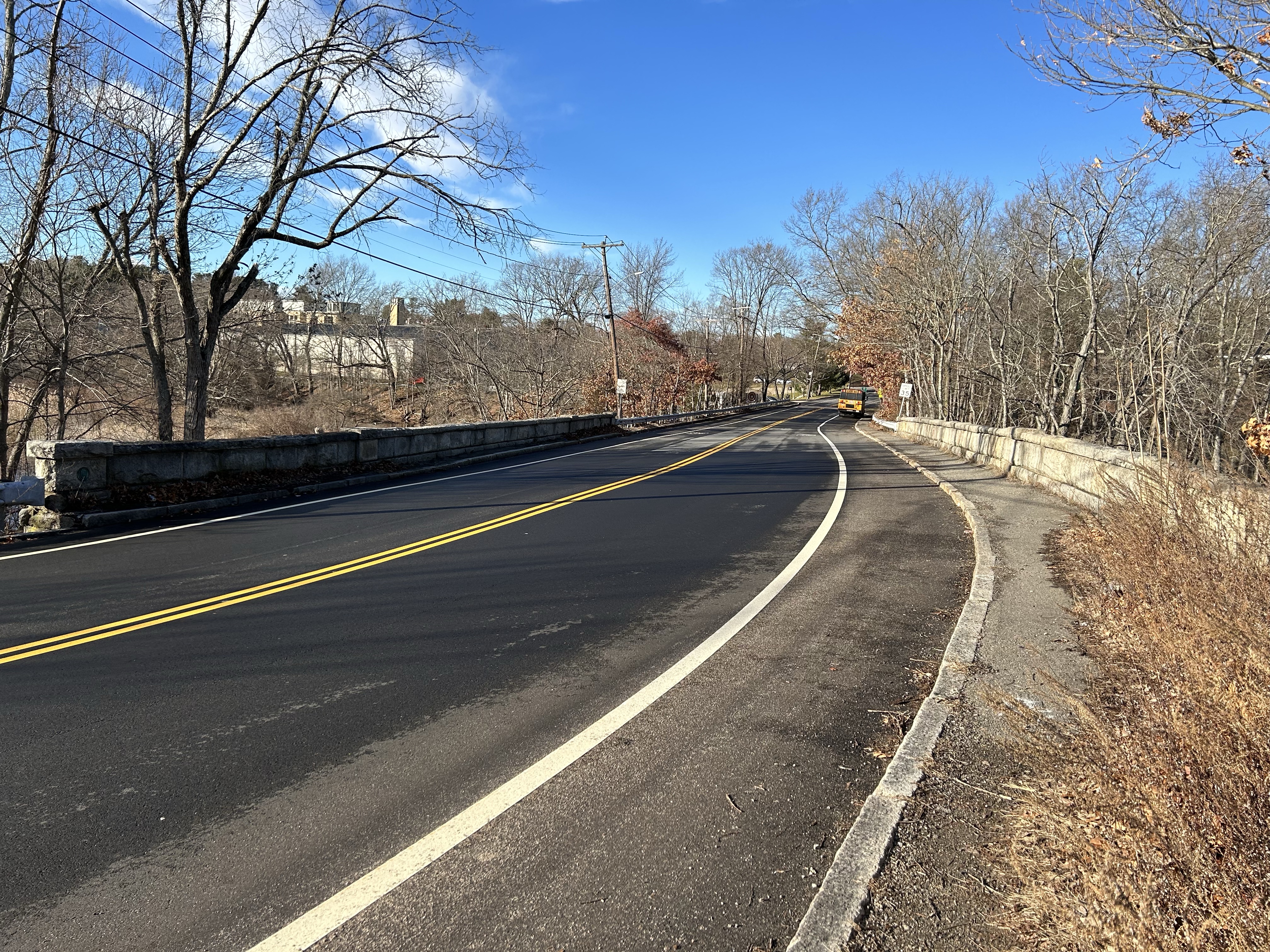
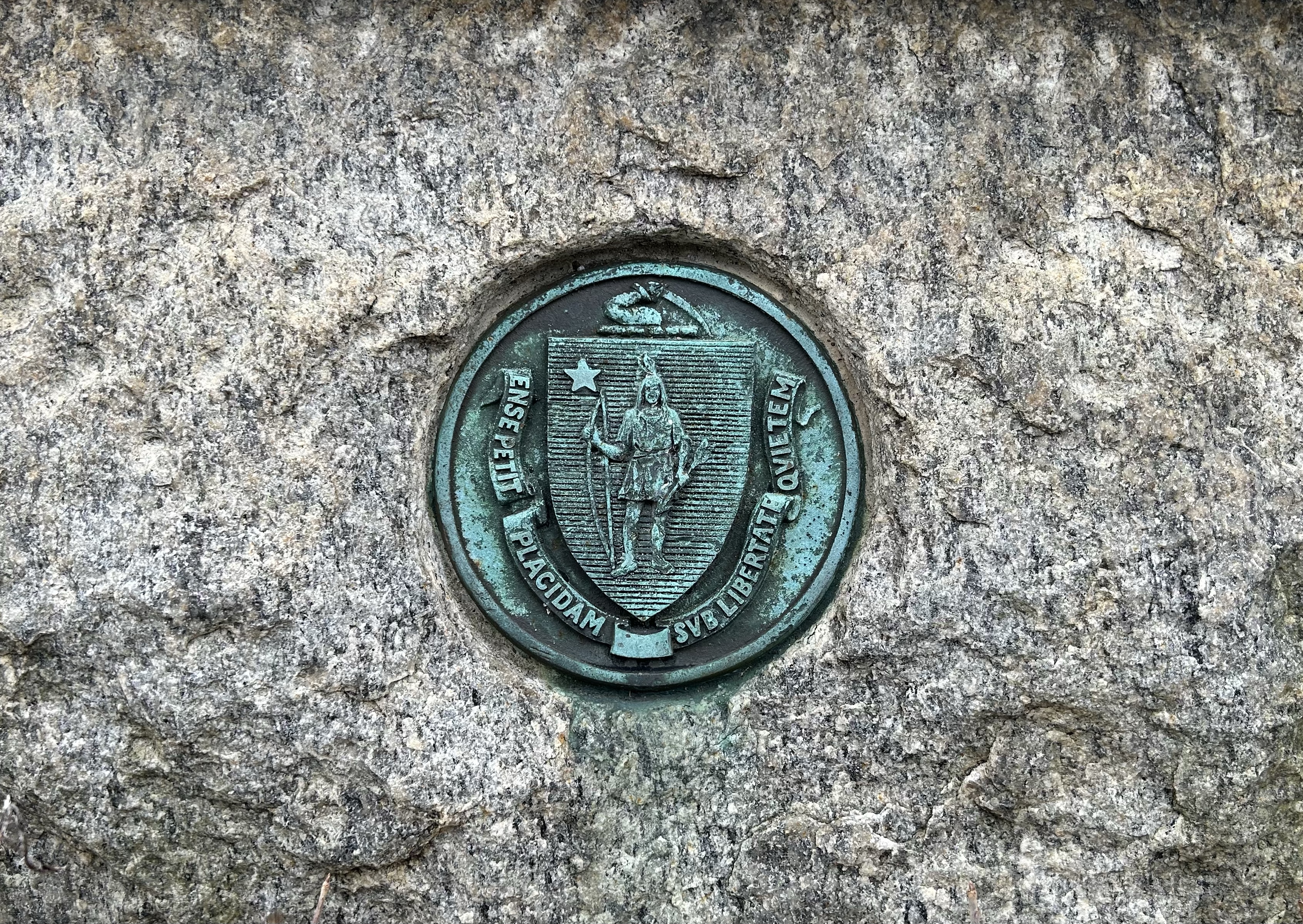
This is the bridge spanning the Charles River at Lyons Street (Dedham) and Greendale Avenue (Needham). The plaque of the state seal can be found on the southwest bridge abutment (just beyond the guardrail on the left in the above photo). There has been a bridge at this site on the river since at least the 1740s; this particular bridge was built in 1879 and is named for a 19th century landowner, Elisha Lyon. At one time Common Street intersected with Lyons St. just south of the bridge, but was dead-ended with the construction of Rte. 128.
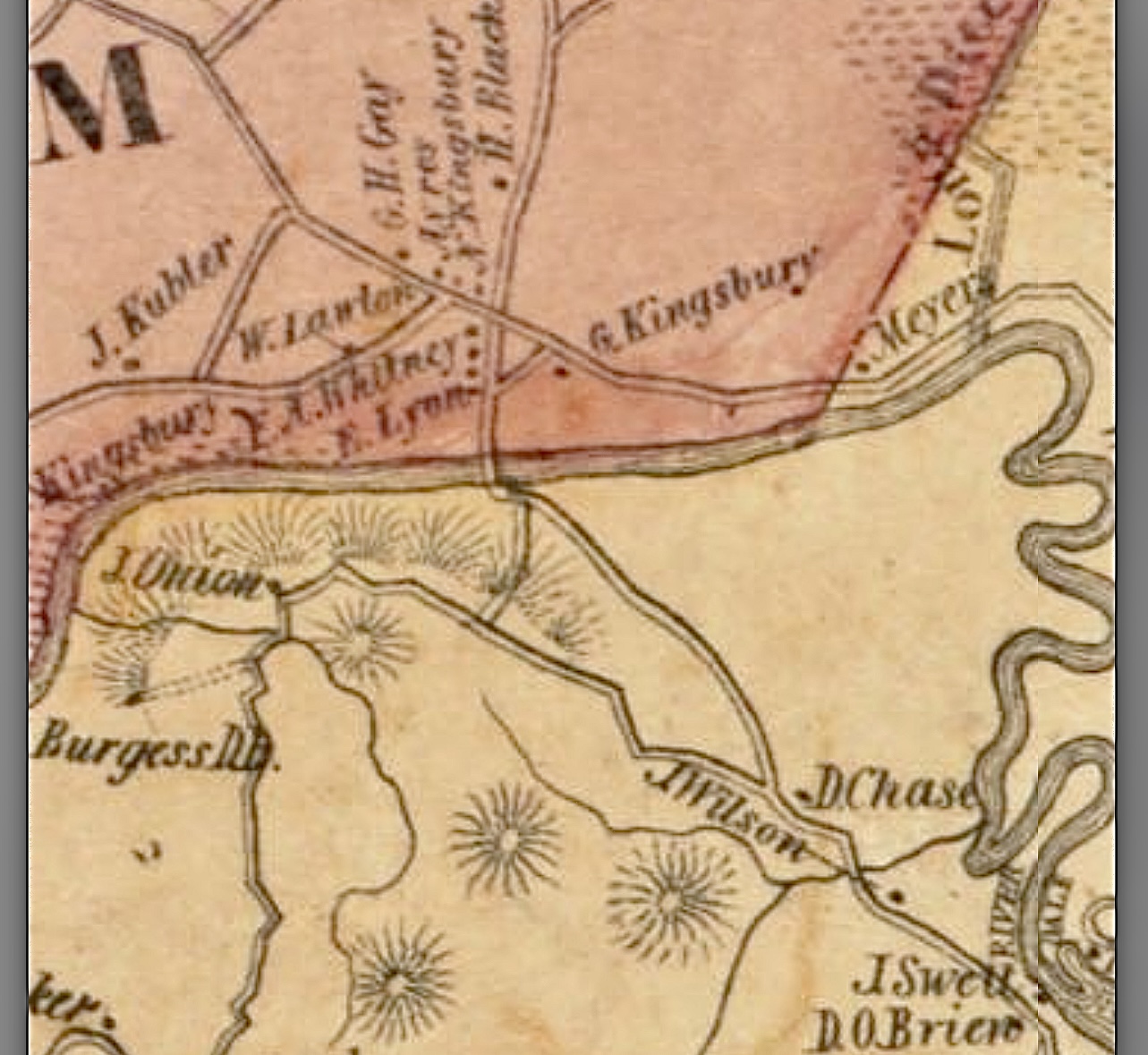
Section of Needham (pink) and Dedham from an 1858 map. Common Street runs from the lower right by the property marked D. O’Brien to Lyons Street just south of the bridge. You can see the property marked E. Lyon on the Needham side by the bridge. Also notice the property of J. Wilson, from which Wilson Mountain gets its name.
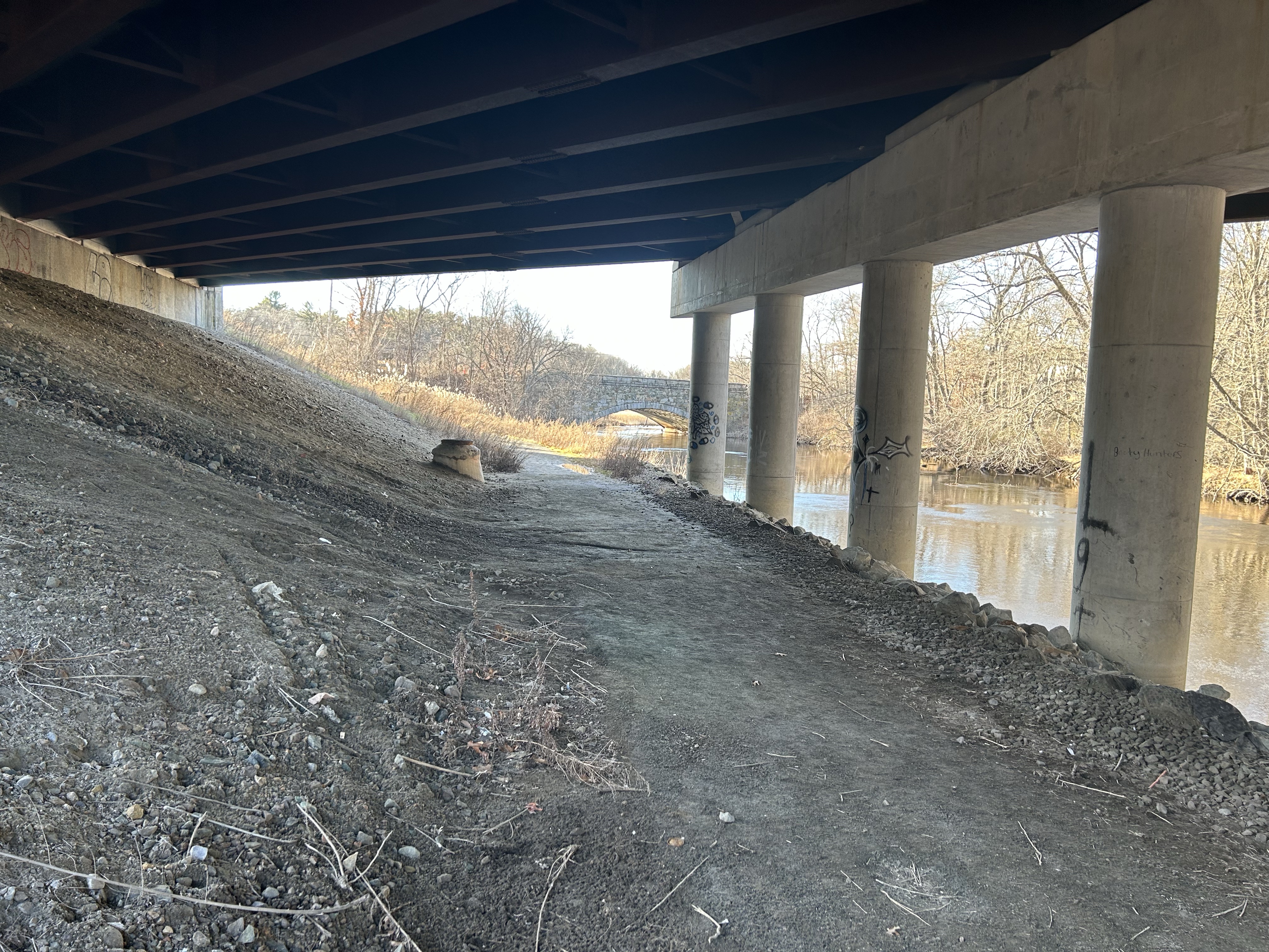
There is a small parking area off Lyons Street and a walking path that travels under Rte.128 and connects with trails behind the Newbridge on the Charles complex. For those of you who have only glimpsed this picturesque spot while speeding down the southbound lane of 128, it’s worth a trip to truly appreciate its scenic charm.
Congratulations to Michael Nee for answering correctly! Thanks to all who participated.
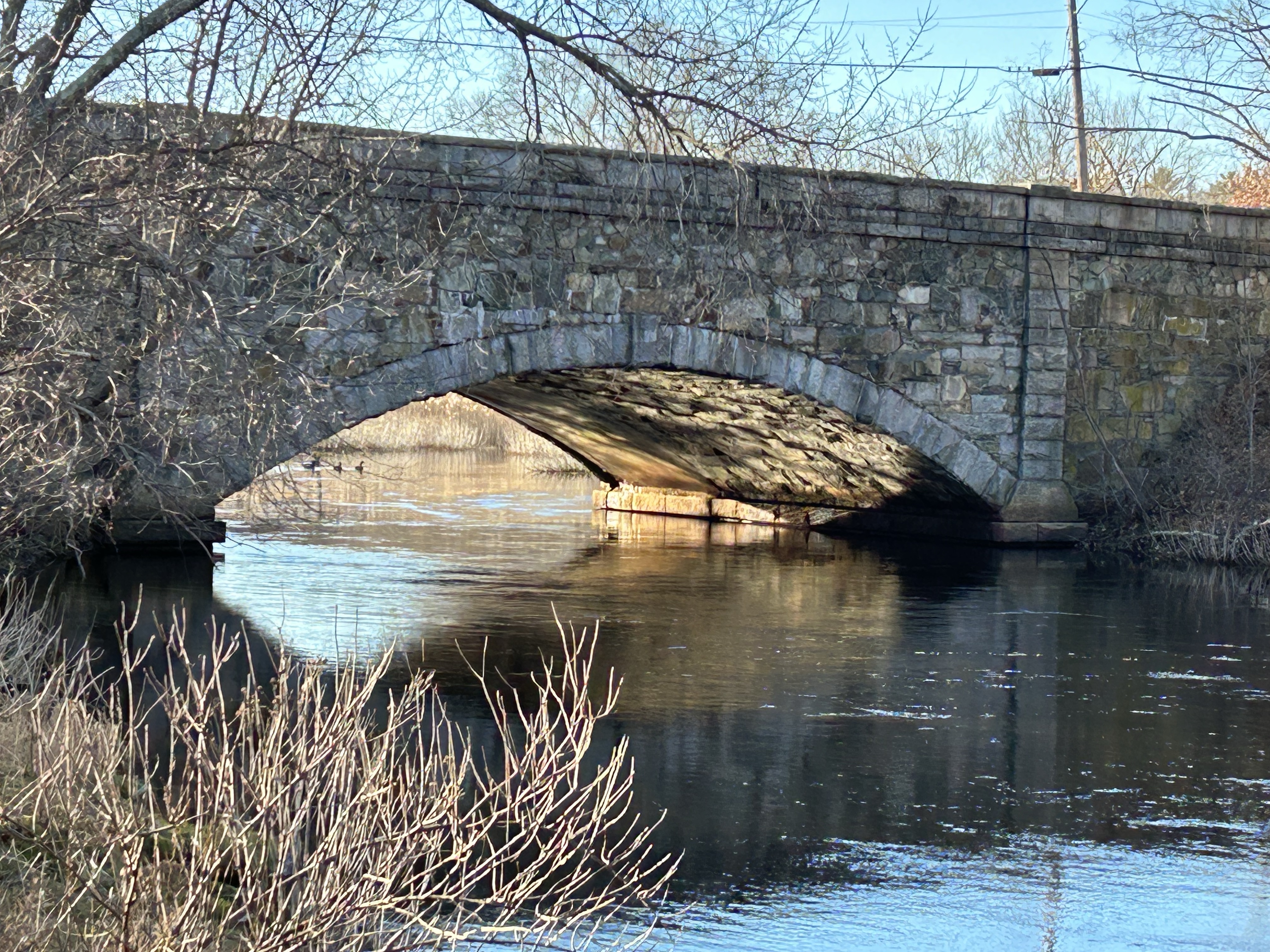
View of the bridge from the Dedham bank of the Charles.The path under 128.
Be the first to identify the location of this photo, and win a copy of my latest book. Remember, do not respond on Facebook! The winner will be the first person to correctly respond in the comments section at the bottom of this page! Parr family members and co-authors not eligible. I will post the correct answer and announce the winner later tonight. Good luck!
This is a fun new feature of the blog that I will post from time to time. The first person to correctly identify the location of a posted photo will win a copy of my most recent book “Murder and Mayhem in Metrowest Boston.” Because I share my blog posts on several Facebook groups, the correct answer must be posted in the comments directly on the blog (found at the bottom of the post where it says “Leave a Reply”). Now, it is true that subscribers to the blog may have a slight advantage as they receive the post directly in their email as soon as it is published, so there’s that. To subscribe, scroll to the bottom of this page and enter your e-mail in the box. Then confirm your subscription by responding to an email you will receive from Word Press.
Sorry, no Parr family members may participate!
The first mystery photo will be posted on Friday, January 20th at 6:00 pm. Good luck!
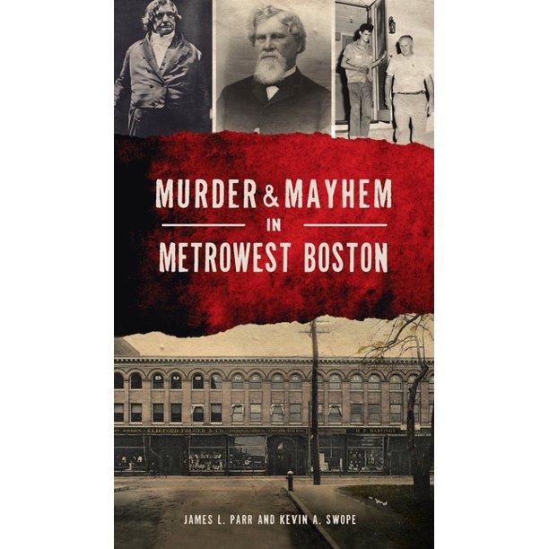
Written with co-author Kevin Swope, Murder and Mayhem is a collection of true crime stories from Framingham, Natick, Wayland and other nearby towns spanning over 125 years. Published by The History Press/Arcadia.
The Pauls of Dedham made significant contributions to the town’s agricultural, civic and political life for almost two centuries. The loss of the 172 year old house in which they resided for eight decades is both surprising and disappointing, but the occasion offers an opportunity to shine a light on this old New England family.
The first Massachusetts settler, Richard Paul came from England sometime between 1620-1630 and settled in the Taunton area, where Pauls would reside for the next hundred years. In 1719 Richard’s grandson Samuel purchased about 100 acres situated between the Neponset River and Sprague Pond for his sons Isaac and Samuel. This area quickly became associated with the Paul family, and the bridge over the Neponset acquired the name it retains to this day, Paul’s Bridge.
Paul’s Bridge 2022. This bridge was built in 1849.
By this time this area of Dorchester had been annexed by Dedham and was known as the “Low Plain.” The house and land eventually came into the possession of Ebenezer Paul, (b. 1818) great-great-great-great-great grandson of Richard Paul. Ebenezer was a respected progressive farmer and member of the Allin Congregational Church (despite living on the edges of town some three miles from the town center.)
Farming pursuits were seriously curtailed in July of 1861 when the US government took over the bulk of Paul’s acreage for a training camp for Union soldiers. According to an article written for the Hyde Park Historical Record (Volume VI, 1908):
” …the first that Ebenezer Paul knew of any designs on his land as a camping ground was the sudden discovery one morn of two or three men sitting under one of the long rows of elms, a few of which are now standing, and his cows gazing upon them with interest. Later, it is said, they came and took the land, leaving him to apply to the State for compensation which he did, and I am credibly informed that he received three hundred dollars per year rental.”
The government also took over about 80 acres west of Sprague Pond owned by Isaac Tower (my childhood street was named for him) who after the war submitted a claim for rent and additional funds for damages done to his house and fences. The government paid the rent but denied the claim for damages.
The first two regiments to occupy the land were the Massachusetts 18th and 20th, and the site was known as both Camp Brigham and Camp Massasoit. Later it would come to be known as Camp Meigs and gain historical significance as the training ground for the 54th Massachusetts, the first Massachusetts regiment of African American soldiers who arrived in February 1863. The history of Camp Meigs and its association with the 54th Massachusetts Regiment is a rich and fascinating one that will not be explored here. There is a brief history of the camp in my book Dedham: Historic and Heroic Tales from Shiretown.
The Ebenezer Paul House (underlined in red) stood north of Milton Street (present-day Neponset Valley Parkway). This map shows the extent of the camp at Readville and its close proximity to both the Paul House and the Edson House. In 1868 most of the land east of Sprague Street would become part of the new town of Hyde Park, which was annexed by the City of Boston in 1912.A section of Dedham from an 1858 map of Norfolk County. The red arrow indicates the original Paul house just west of Paul’s Bridge and the Neponset River. The blue arrow indicates the house at 390 Cedar St. where Ebenezer moved with his family in 1867. The house just east of that house (labeled N. Fales and S.F. Alden) was the home of Elizabeth Fales, who was murdered by Jason Fairbanks in 1801. It stood on the southeast side of Cedar St. near present-day Turner St. (See my earlier post “May 18- A Tragic Anniversary” from May 2010).
Ebenezer Paul sold his property and moved to the Cedar Street house in 1867, along with his wife Susan Dresser Paul and five children; Henry, (b.1851), Edward (b.1853), Isaac (b.1856), Ebenezer (b.1858), and Martha (b.1865). Upon his father’s death in 1898, Ebenezer Talbot Paul took ownership of the property and he and his wife Marietta Taylor Paul began the next chapter of the Paul family in Dedham.
I am James L. Parr. I grew up on Tower St. and went to St. Mary's and Dedham High (Class of 1977). I teach school in Framingham and co-wrote a book of Framingham history, which led me to write a book of weird Dedham history called Dedham: Historic and Heroic Tales from Shiretown. That book led to this blog. To order your own copy of the book, e-mail me at jameslparr@yahoo.com